Total Items: 0
Sub Total: $0.00

This is the trip report, the hard-earned lessons, and the full packing guide of what worked, what didn’t, and what I’d change next time walking the CDT southbound from Canada to Mexico in 113 days.
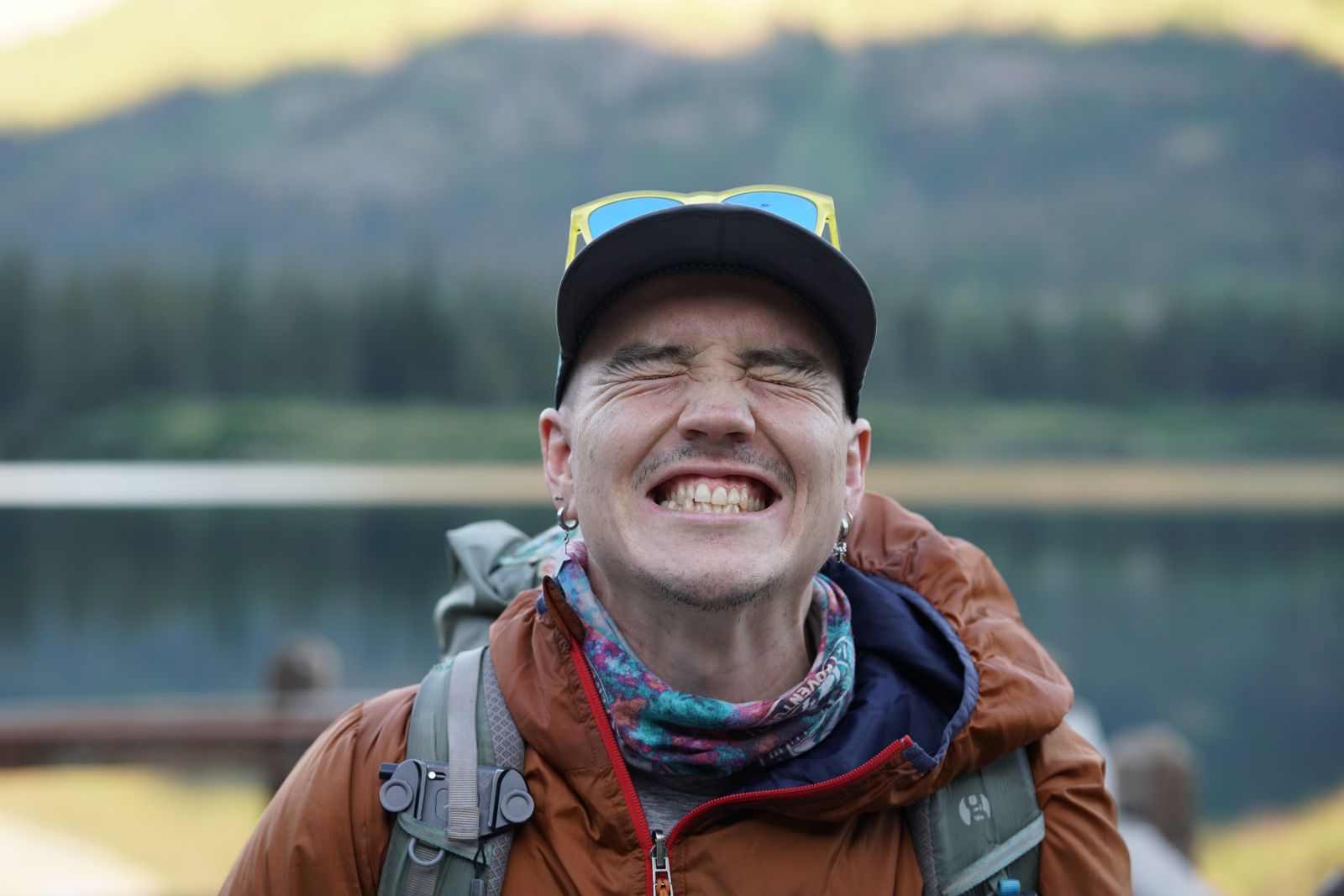
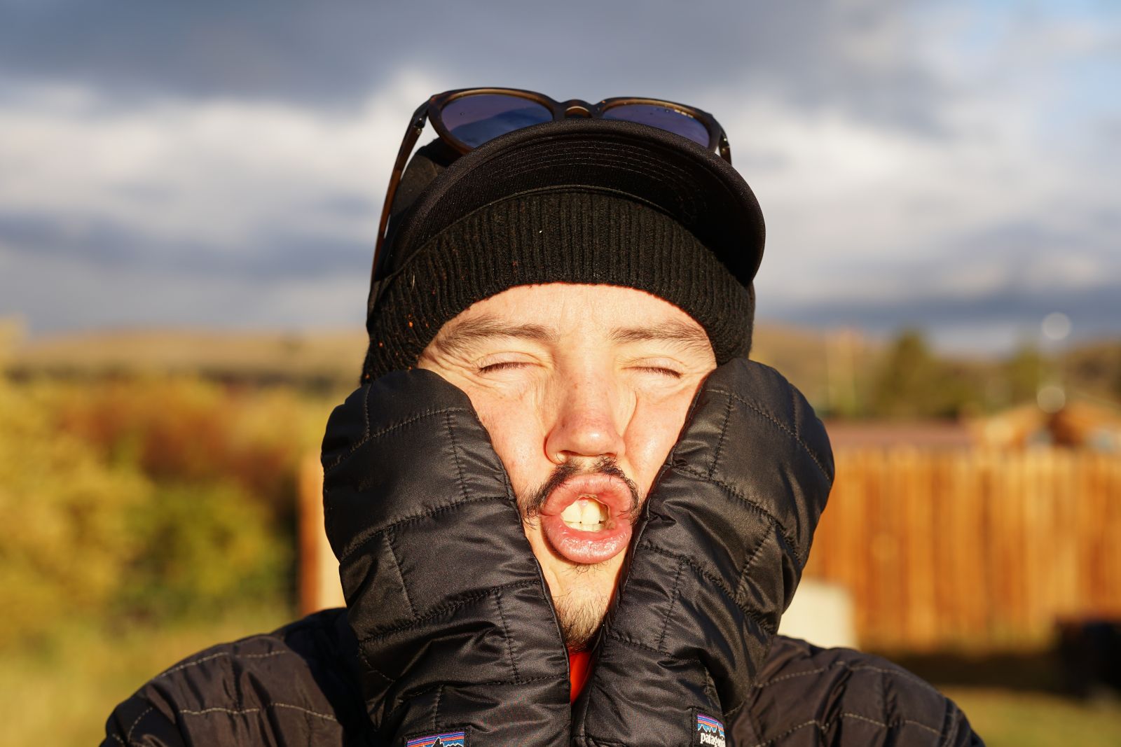
“I’m Reid, Brisbane-based outdoor enthusiast, endurance athlete and author of your favourite local hiking guidebook. Thru-hiking is one of my favourite activities, and I’ve currently completed the Appalachian Trail (AT), Bibbulman Track, Australian Alps Walking Track (in Winter), and now the Continental Divide Trail (CDT)!”
From geysers and secluded hot springs to grand mountain summits to deserts and cacti, the Continental Divide Trail has it all. Conditions vary significantly as you travel from the Canadian to the Mexican border, and you’ll need to be equipped to face all obstacles. Learn from my mistakes, chuck on your backpack, and explore the Rockies in the most difficult way possible - on foot.
Note: I have a wealth of experience doing similar activities - what worked for me might not work for you. The CDT is dangerous in many ways. Conditions change from year to year, and the weather changes rapidly. But don’t let that stop you, it’s worth it. Just take it seriously, plan ahead and prepare.
Route: Continental Divide Trail (Southbound – Canadian to Mexican border)
Days/nights: Expect to take anywhere between 120 and 150 days (inclusive of rest days in your favourite towns along the way).
Distance: Distance: 4,878 km is the official distance, but expect to hike between 4,506 and 4,989 km, depending on wildfires and chosen alternate routes.
Navigation/logistics: The FarOut app will be your best friend on this hike - with reliable and up-to-date information on water availability/quality, changing conditions and hazards, and GPS navigation. This costs about $80AUD.
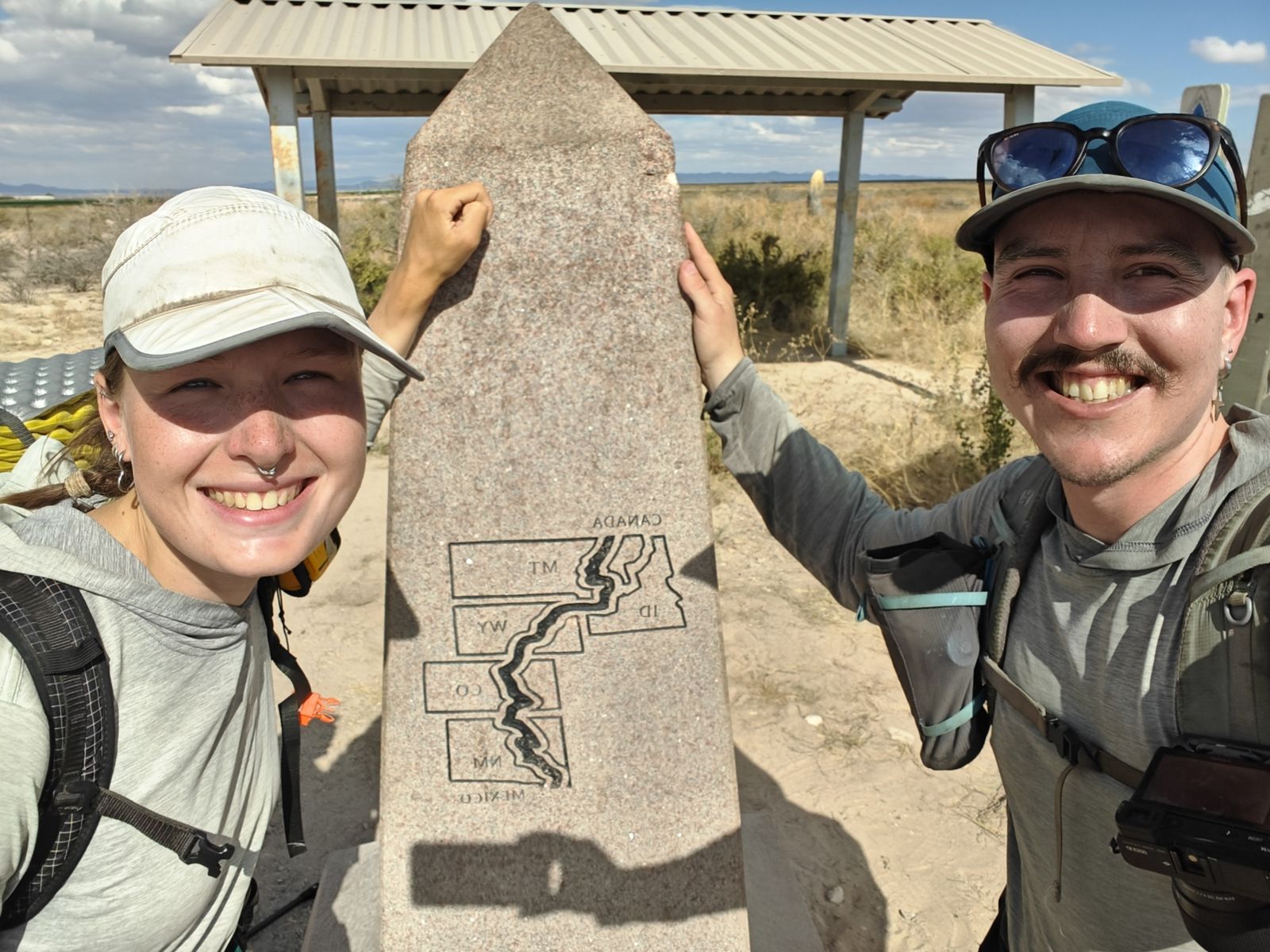
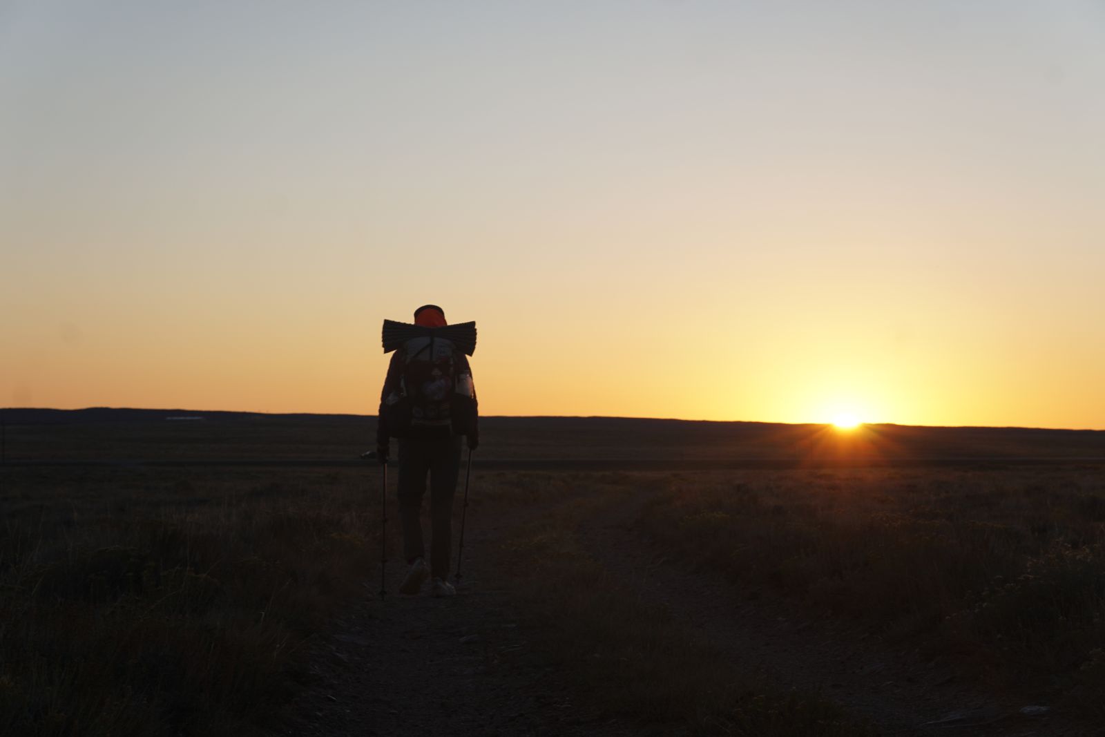
Wombat and Ratatouille at the Mexican border after four months of hiking and camping.
Starting southbound in summer, temperatures start mostly warm during the day and cool overnight (12-30°C). Water is abundant and delicious in northern Montana, becoming increasingly more sparse towards the Idaho border (up to 20-mile carries (32km) - yes, you will absolutely need to get used to using miles).
The terrain is rocky, mountainous, forested (including large swaths of burnt forests), and harbours both grizzly and black bears (and, less dangerously, an abundance of elk and moose). The elevation ranges from 5,000 to 8,000 ft and is almost entirely below treeline. We had perfectly sunny weather for almost all of Montana, save for a few thunderstorms near the start of our trip in Glacier National Park. Camping options are plentiful and spectacular.
Permits are essential for travel through Glacier National Park, which is where you’ll start the hike. These can be difficult to acquire and are best secured in person (fortunately, they set aside reservations for walk-in CDT hikers, but some flexibility is required). After leaving Glacier, you’ll be able to camp wherever you like for free until you reach Yellowstone NP in Wyoming. Just remember to always store your food and other scented goods in a bear-safe manner (PCT hang method or bear canister).
Reaching the start of your CDT hike can also be challenging, especially for non-US or Canadian citizens. You’ll have to fly into a nearby airport (Bozeman, MT or Missoula, MT) and organise a shuttle to one of the recognised terminuses (Chief Mountain will likely be your best bet). I luckily have a friend in Montana who was able to drop me off at a nearby trailhead in Glacier National Park.
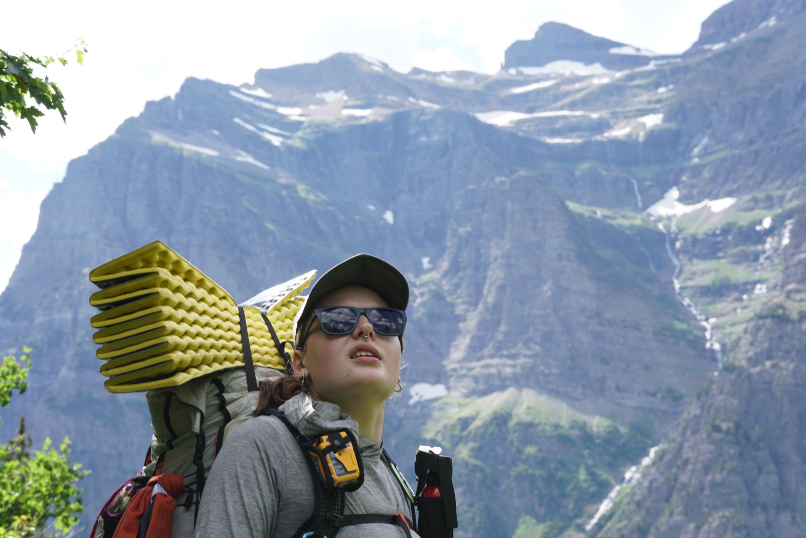
It’s hard to get the mountains in frame in Glacier National Park
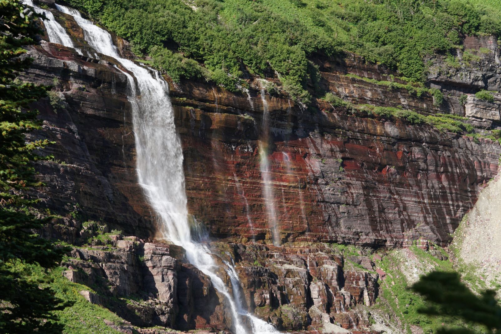
Lush scenery in Glacier National Park
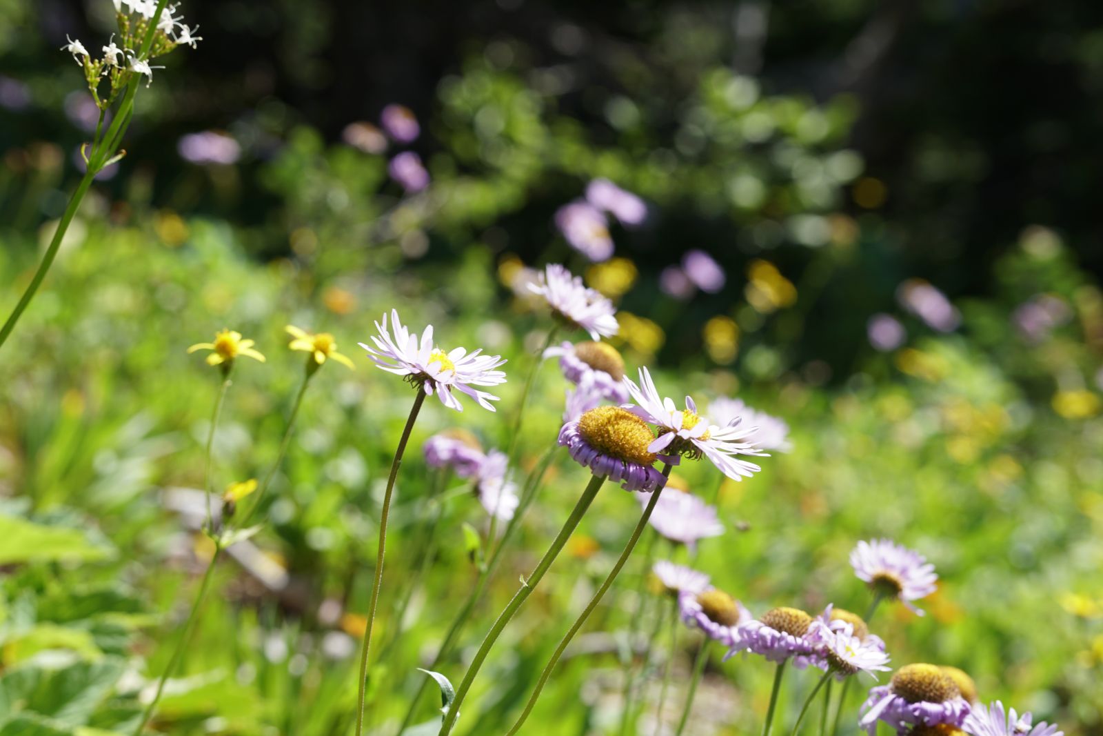
Wildflowers blooming in Glacier National Park
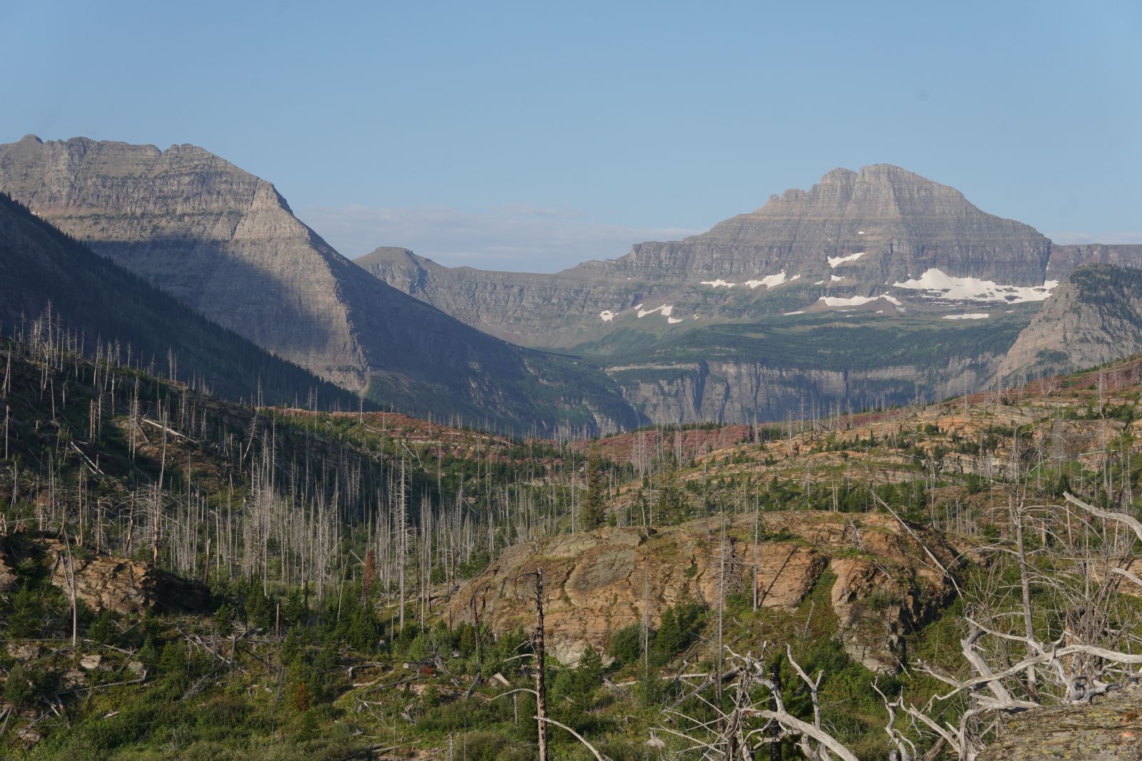
Burnt landscape in Northern Montana
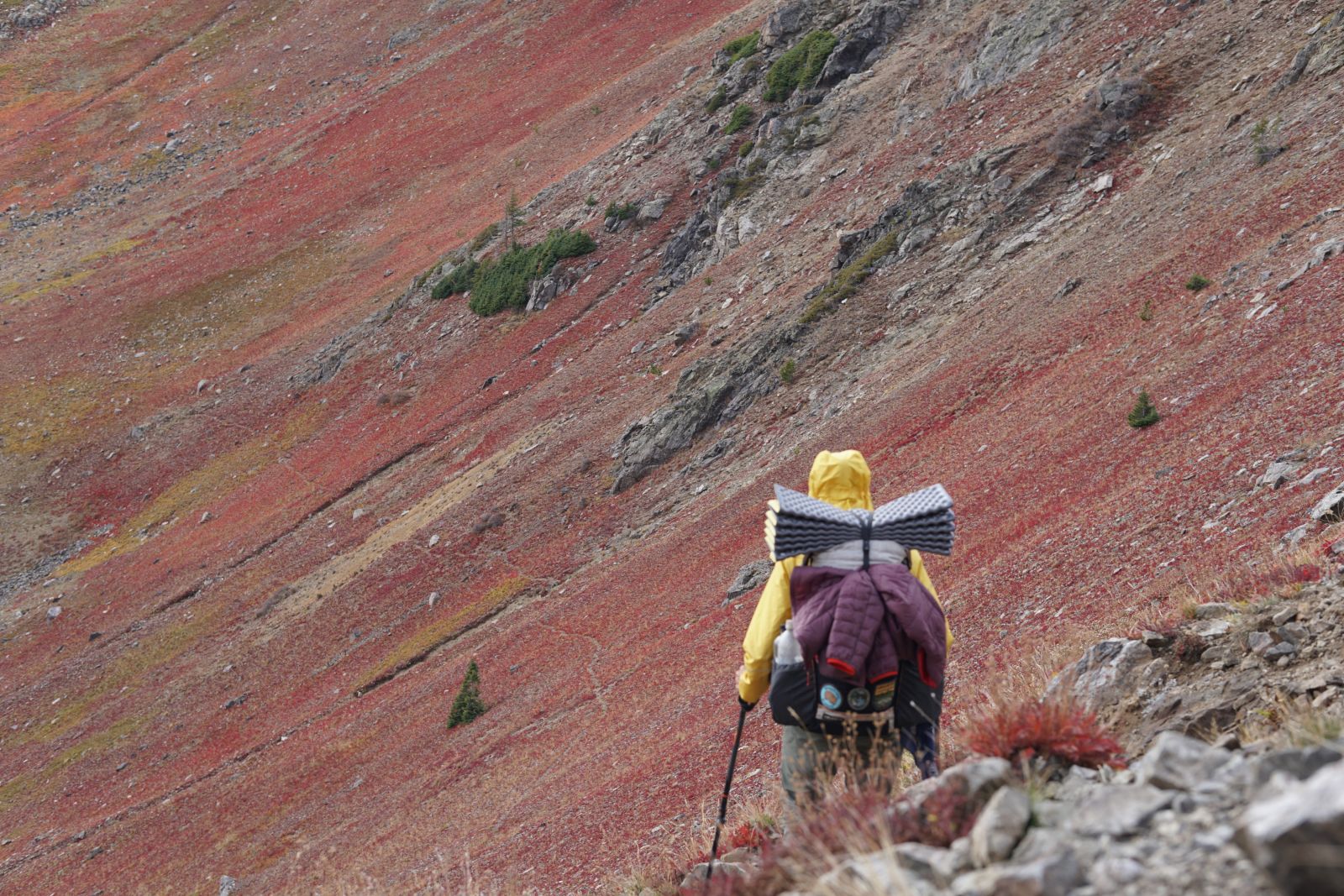
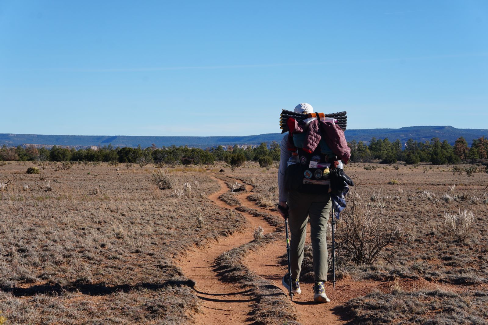
Further increasing in elevation, ascending several times to 10000 feet, Idaho is the first state on the CDT where you’re above treeline for long stretches of time. The terrain becomes even rockier as you hike along ridges between small towns (you’ll need to resupply at two gas stations and rely on pre-arranged shuttles to get you to them, as some of these country roads have next to no traffic). Temperatures remained mostly warm for us in Idaho, and there are multiple sections of extreme heat and exposure through burnt forests - long sleeves, hat, sunnies, and sunscreen are essential (Australians are the best at this). Idaho also has multiple long water carries and unreliable water sources.
The trail traverses the Montana/Idaho border for long stretches (that is why the exact distances of Idaho and Montana are not perfectly known) and passes through several hunting areas, so make sure you have some high-visibility clothing. There are a few hidden gems throughout Idaho, including secluded caves, stunning ridge walks (without the Colorado thunderstorm danger), and some nearby geothermal features. But what made Idaho so enjoyable for us was the small historic towns full of character and charm, especially Leadore.
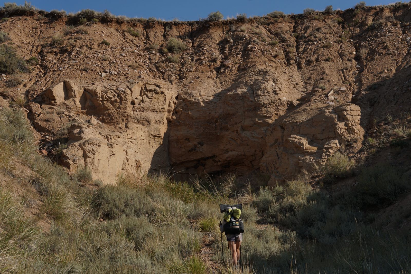
Secret cave along the Idaho/Montana border
Generous trail magic left to hikers along the trail
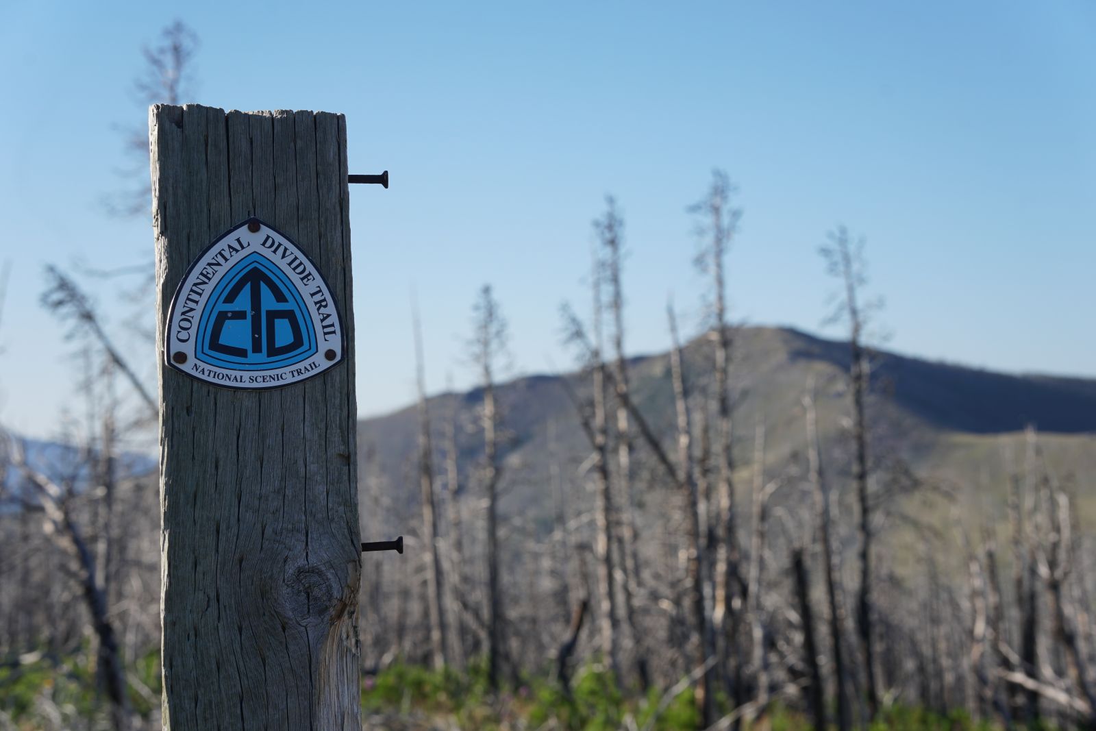
CDT trail marker before a long stretch of burnt forest
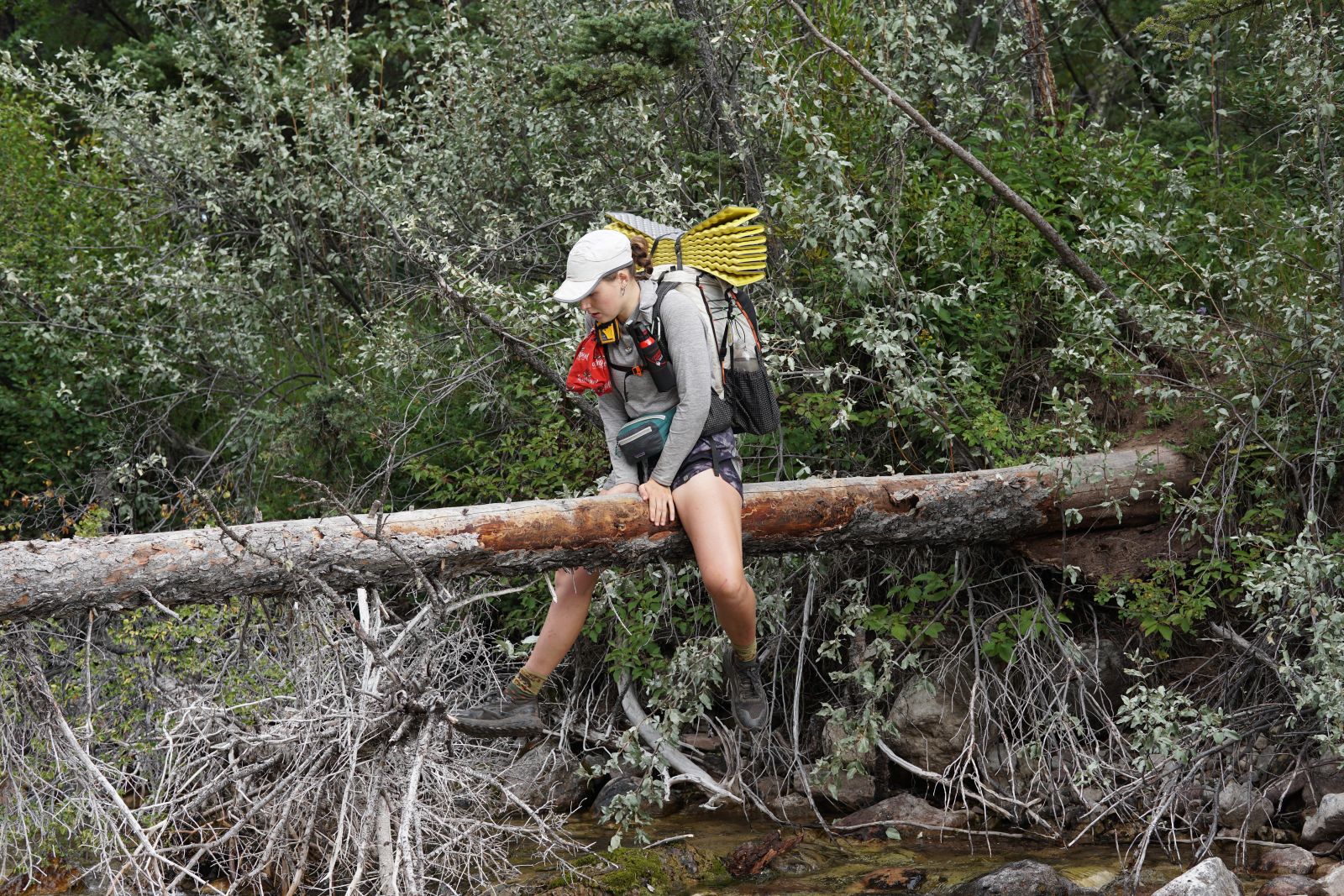
A thru-hiker will do anything to keep their feet dry
Wyoming starts with an explosion of steam erupting from Old Faithful in Yellowstone NP. You’ll have to secure permits over the phone before entering the park, but we had no issue with availability at the further afield backcountry sites. Walking alongside such lively geothermal features is a true highlight of the CDT.
We were fortunate enough to avoid most wildfires until we reached central Wyoming. Here, the Dollar Lake fire made it too dangerous for us to traverse the Wind River Range — a section I was particularly excited for. Having successfully paid to be shuttled around the active fire, we resumed near the start of the desolate Wyoming Basin. This section is flat as a pancake, devoid of natural water sources, exposed to the sun, and low on shade. Water carries through this section are long and heavy, often 30 miles (48 km) apart. Wells and ponds for the nearby cattle are the only water sources, and these range in quality from rapidly evaporating ponds of warm water and cow shit soup to covered solar-powered wells where you can drink it before it gets to the cows.
Antelope, specifically pronghorns, alongside ermin, coyotes, wild horses, and elk, inhabit this vast desert and are easy to spot across the landscape. Grizzly bears seldom travel in the basin and aren’t found any further south, so you can donate your bear spray in the next town. However, the real danger here is the weather, because you are guaranteed to be the tallest object whilst hiking (did I mention there are no trees?). So pick a good weather window for the Basin and gun it — we recommend hiking 30+ miles (48 km +) per day as we did to minimise water carriage and likelihood of bad weather surprising you.
After the basin, near the Colorado state line, you are rewarded with the return of non-shrub vegetation. Some of the most beautiful non-shrub vegetation that there is - autumnal aspens. And these only become more ubiquitous as you cross into the mountain state.
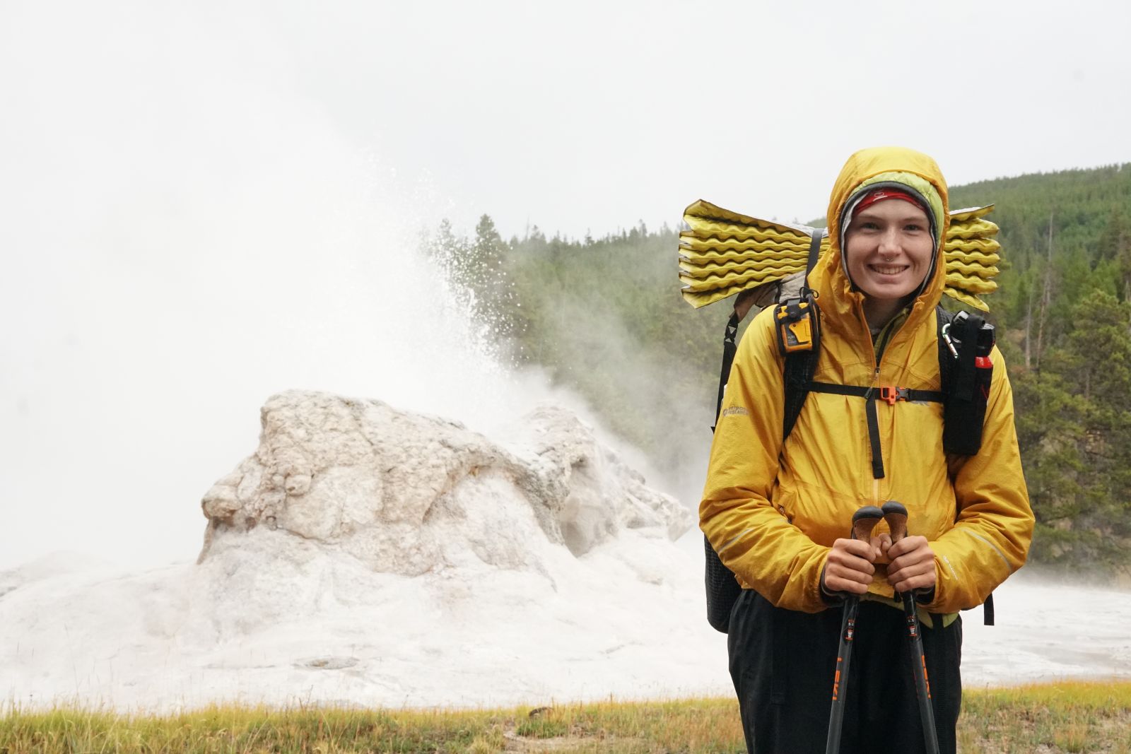
Ratatouille standing before an erupting geyser
The Big Agnes in ultimate ventilation mode in the Wyoming Basin
The desolate Wyoming Basin
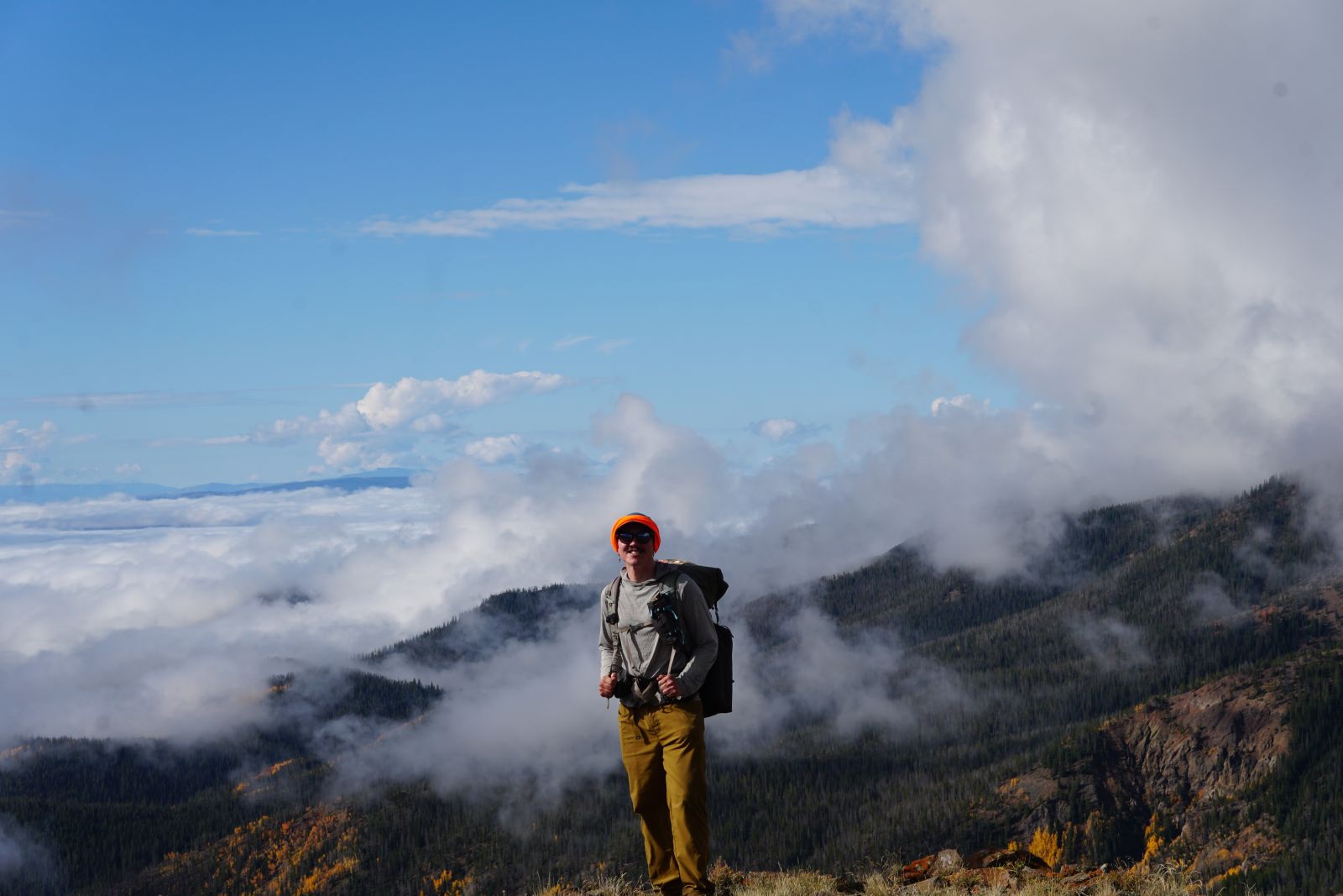
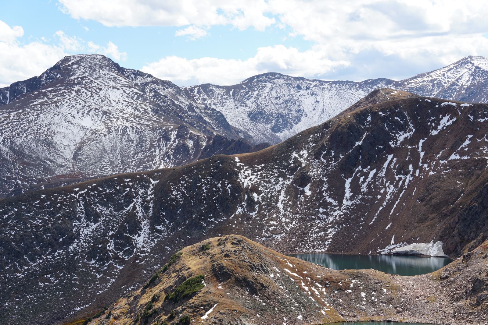
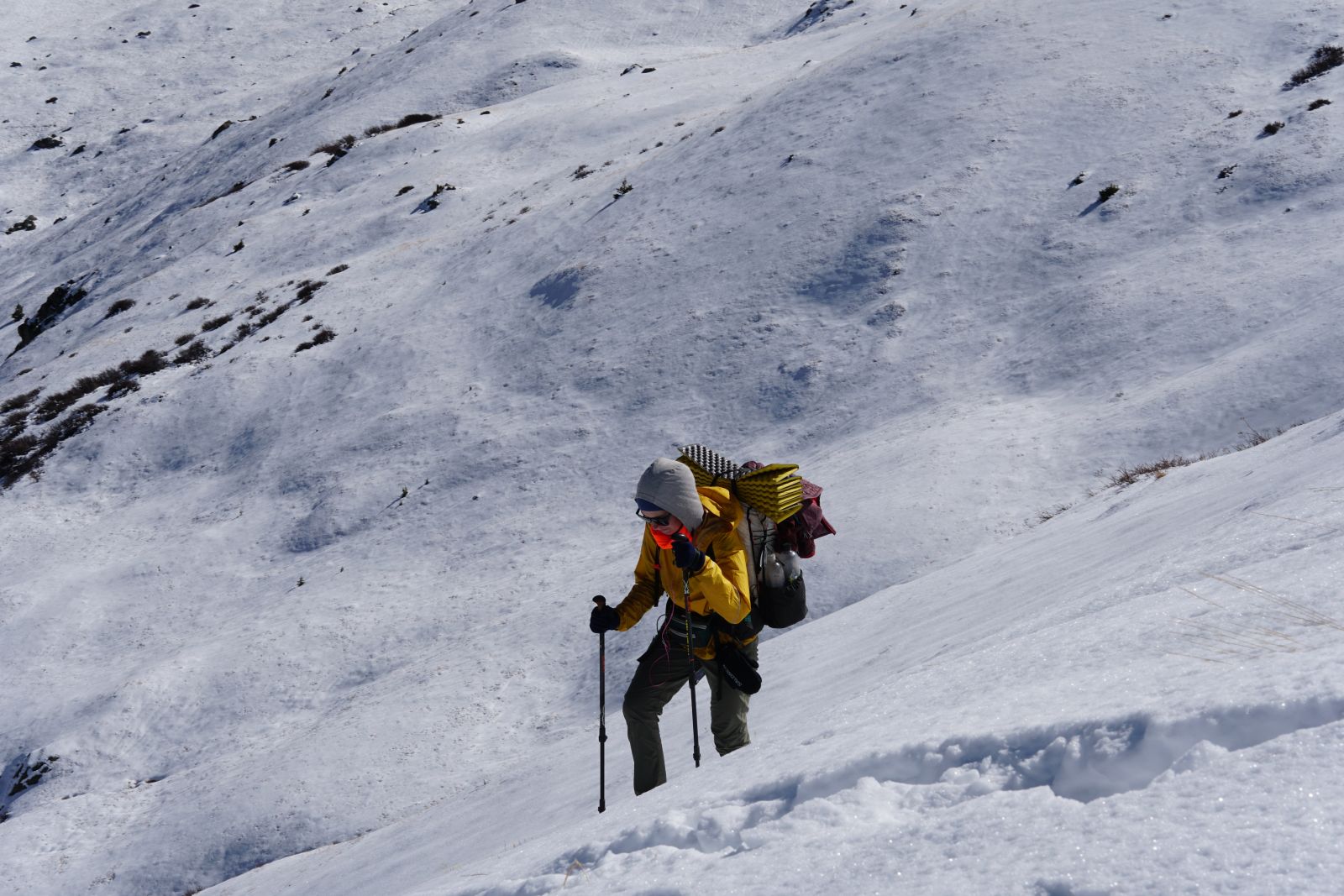
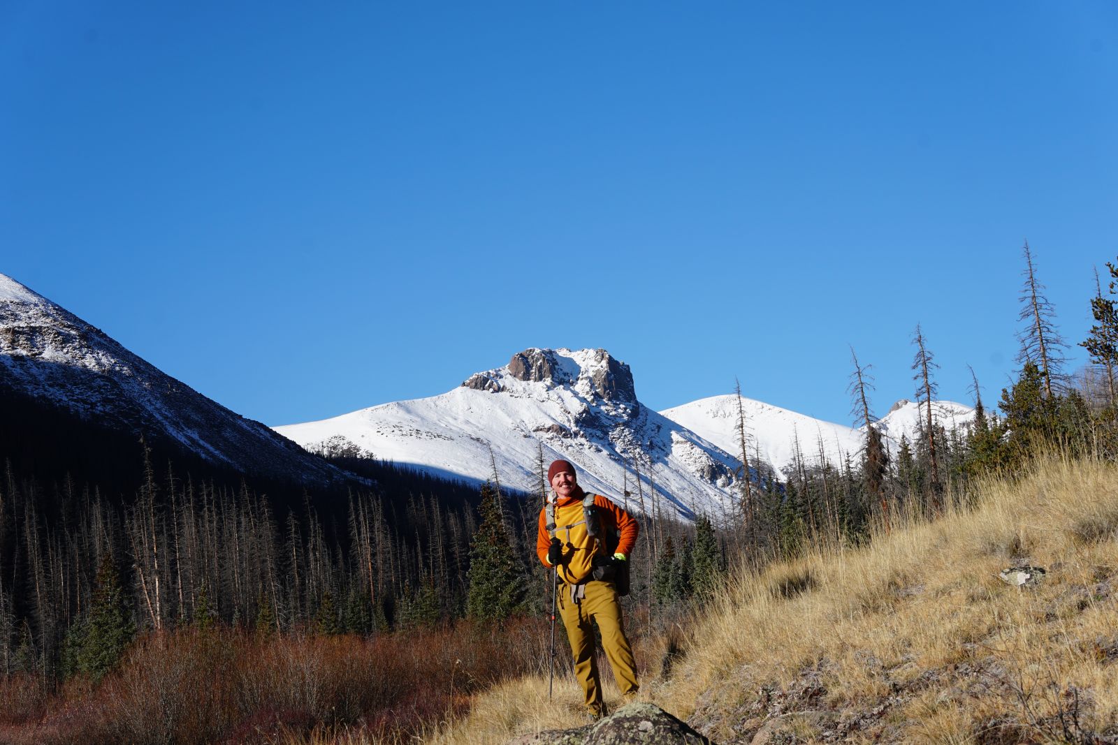
Most of your CDT hike planning needs to go into planning for Colorado. Colorado has the most challenging terrain, the highest peaks (up to 14000 feet - that’s 2 Mt Kosciuskos stacked on top of each other), the most dangerous weather systems, and the most freezing cold. It is not uncommon to get a lot of snow in late September or early October before true winter kicks off. The snow can become dangerous and impassable quickly, especially without proper mountaineering training and equipment. That is why most SOBO thru-hikers plan to be finished with Colorado by the 1st of October, which I think is a great idea.
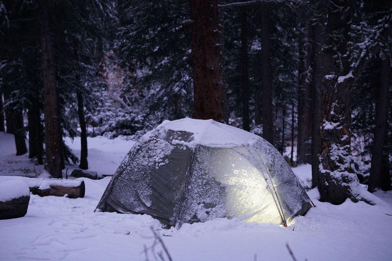
Our hike started an entire month after most SOBOs, so we had a lot of catching up to do if we wanted to get through Colorado in time. We didn’t quite make it, as we finished Colorado around mid-October. We were inundated with a ton of early-season snow, the weight of which almost collapsed our tent. The nights were well below 0°C, which added the additional challenges of staying warm, keeping water as a liquid, and keeping shoes from freezing.
But to experience the snow in Colorado was truly a highlight of the trip, made manageable through microspikes, some post-holing, and gumption. A lot of time was spent hiking and camping between 12000 ft and 14000ft, which can certainly take its toll. Pair that with continuous climbs and descents makes Colorado a low-mileage state. Our average dropped from 25-30 miles per day through Wyoming to a meagre 20-23 in Colorado.
Water is plentiful again in Colorado, but several streams have elevated heavy metals (thanks to historic mining practices) that you should not drink out of unless it’s an emergency. But reading the guide ahead of time should always do the trick.
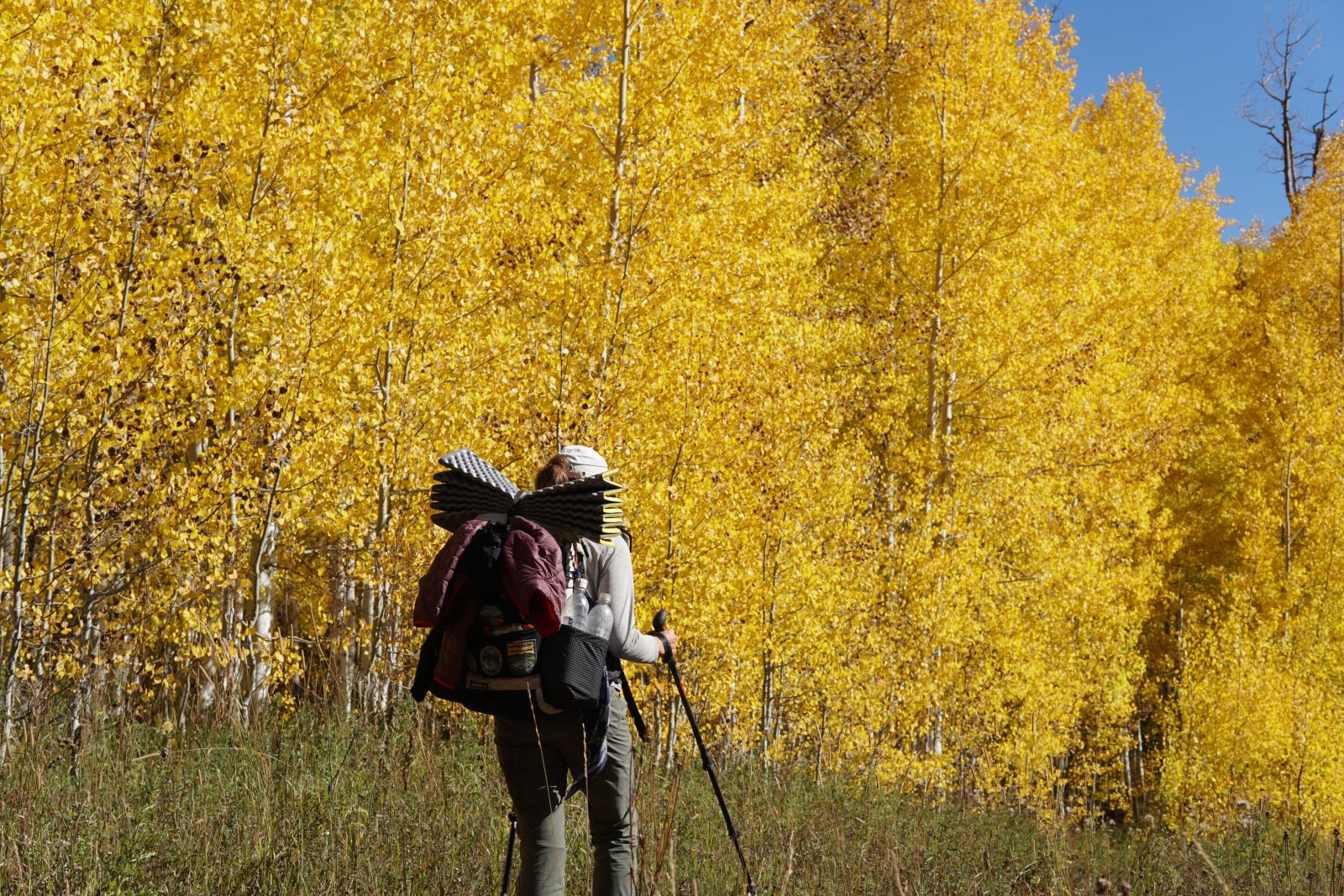
Aspen foliage in Northern Colorado
Morning fog clearing off the Rockies
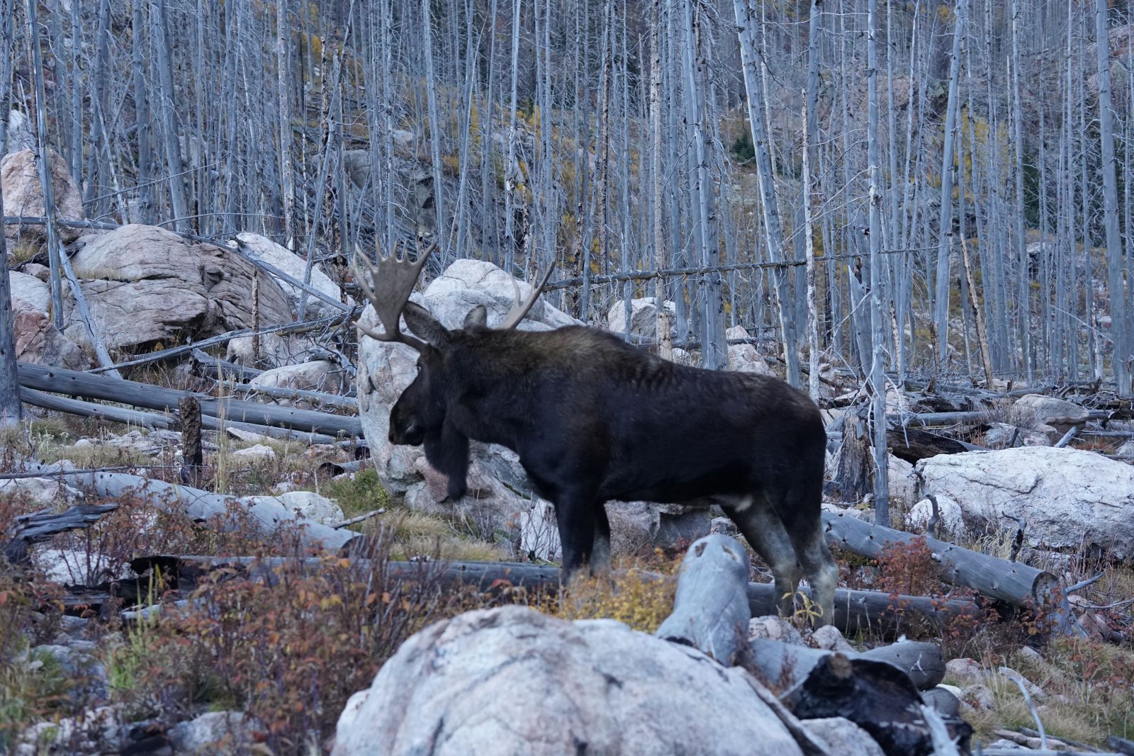
A nonchalant moose on the trail in Rocky Mountains National Park
Lichenous rock
Just Colorado views
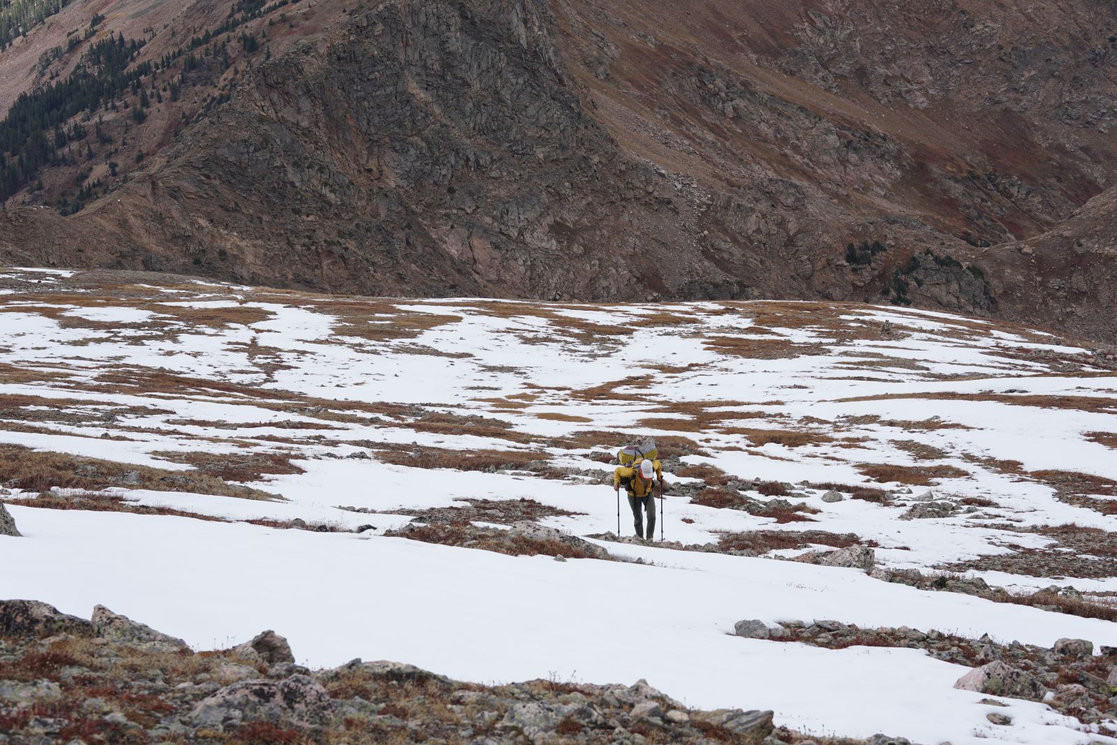
Ascending steep, snow-covered mountains in Colorado
The Big Agnes after a fresh dump of snow
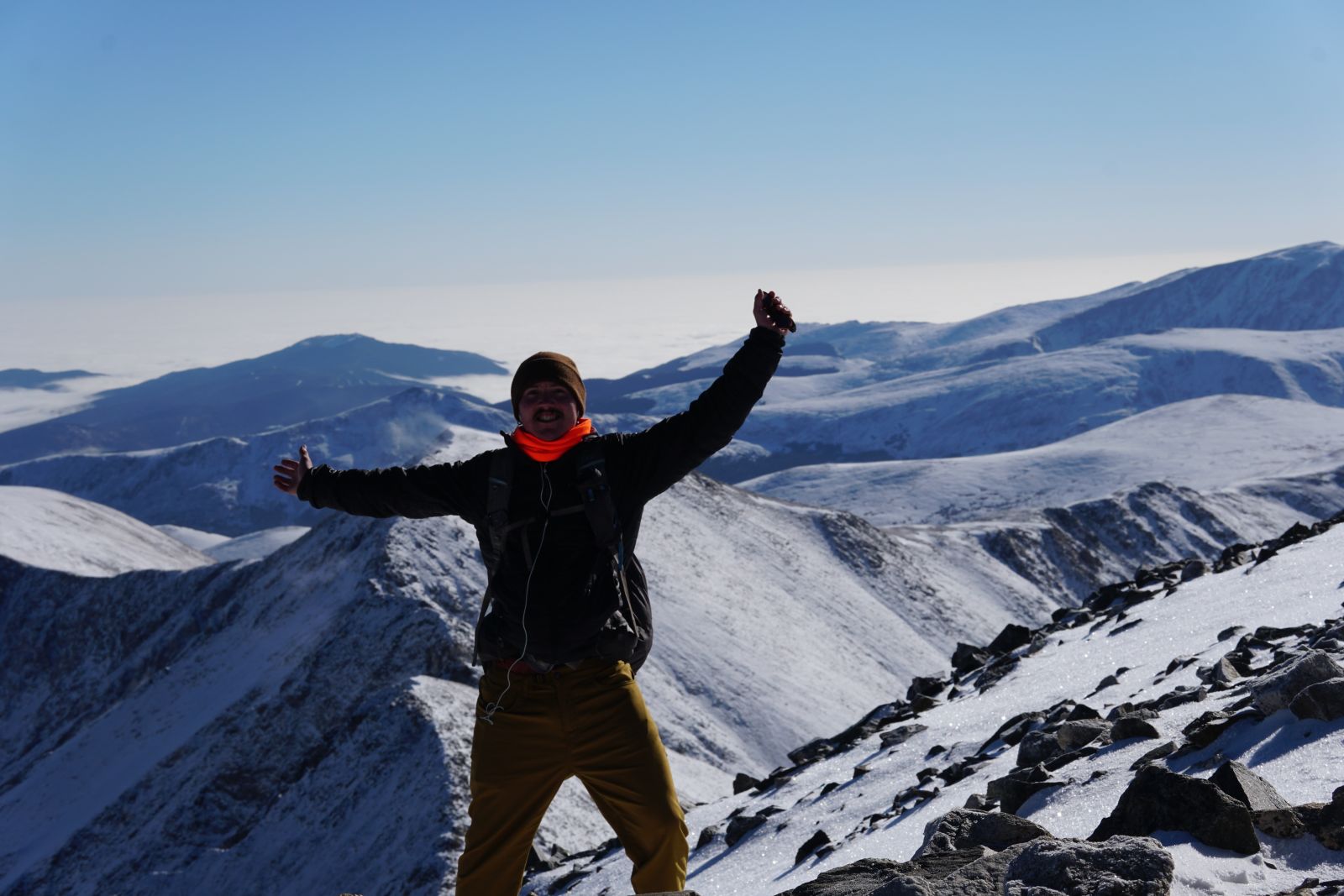
Atop the tallest peak on the CDT - Grays Peak (14,276ft)
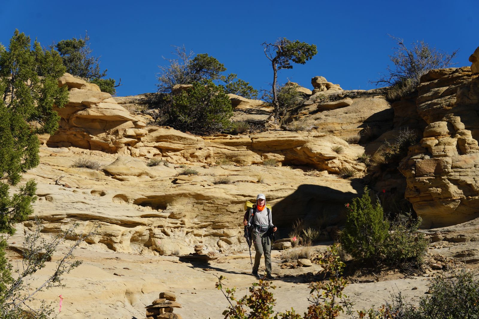
Once we crossed into New Mexico, a sense of relief overwhelmed us. The dangers of the snow-covered passes, the beyond-freezing nights, and exposed campsites were all behind us. The terrain and landscape change almost immediately. Where in Colorado, stark, dramatic peaks erupt out of the ground, here in New Mexico, hills roll, water carves canyons into the sandy soil, and cacti fill in the high desert.
The hiking here is easier and mostly downhill (descending gradually back down to 5000ft), but definitely not boring. New Mexico is equally as stunning as any previous state, with highlights like the Gila River, hiking atop mesas, spotting mountain lions and Mexican wolves.
Stopping in New Mexican towns and eating New Mexican cuisine is a must. Everything is cheap and delicious - a stark contrast to the expensive and mostly bland food that gets transported long distances to the mountain towns in previous states. These towns are also thriving with culture, with strong influences from both native Pueblo nations and Spanish colonialism. Definitely check out some museums while you’re in the area, too.
Later in New Mexico, you will have to walk in a straight line through the high desert for multiple days. Water is supplied by generous townsfolk in caches along the way (and sometimes beer and soda). This can be laborious, and multiple audiobooks are recommended, but you’ll likely see many tarantulas and flowering cacti along the way.
Finally, you’ll need to organise a shuttle from the New Mexican border monument to a nearby town (we chose to go to El Paso as that is an easy airport to fly out of), but the shuttles are expensive as the distances and times required of the drivers are a lot. Now you’re finished.
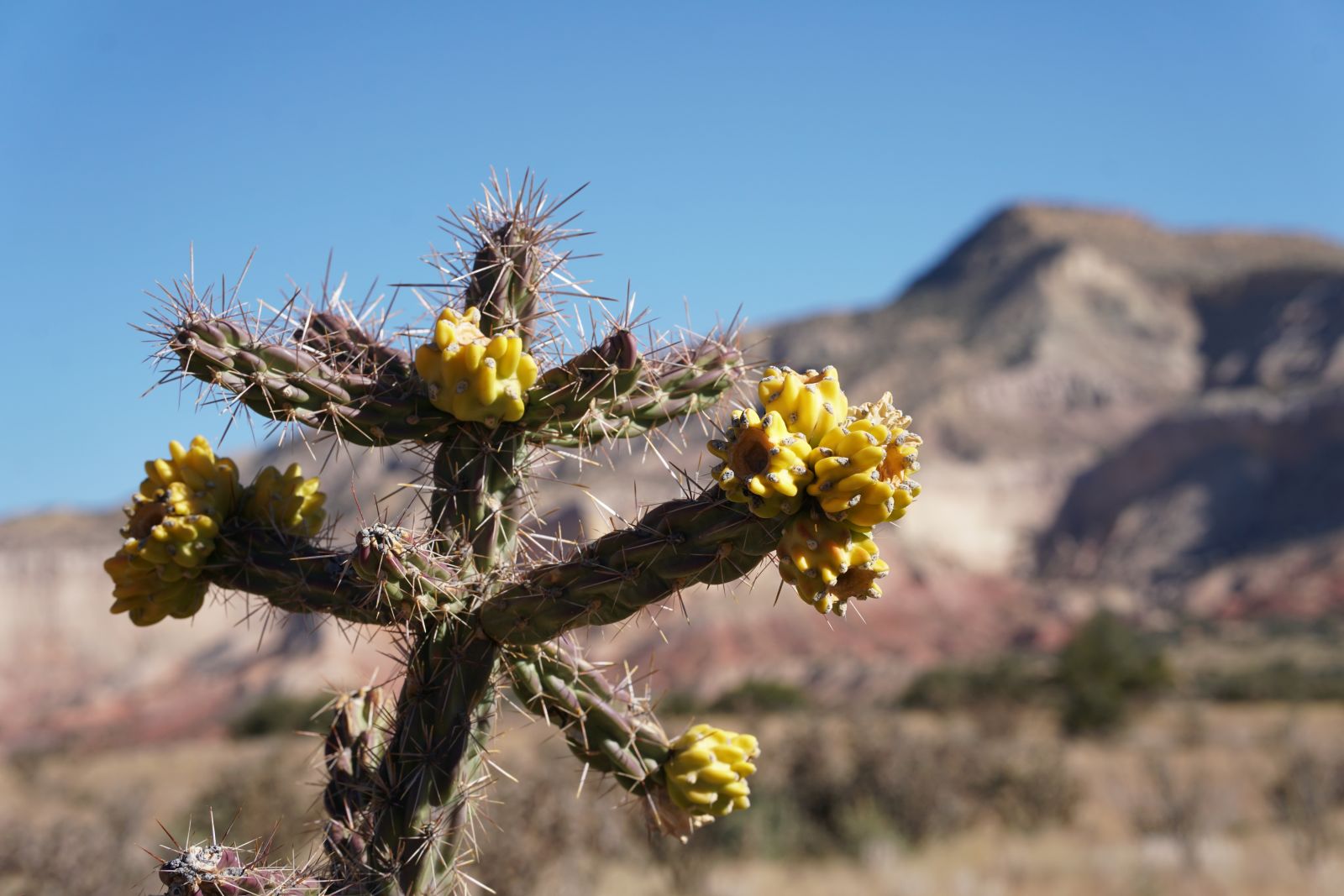
Cane cholla flowering in Northern New Mexico
Ratatouille descending from a mesa by following cairns
Wombat atop a mesa
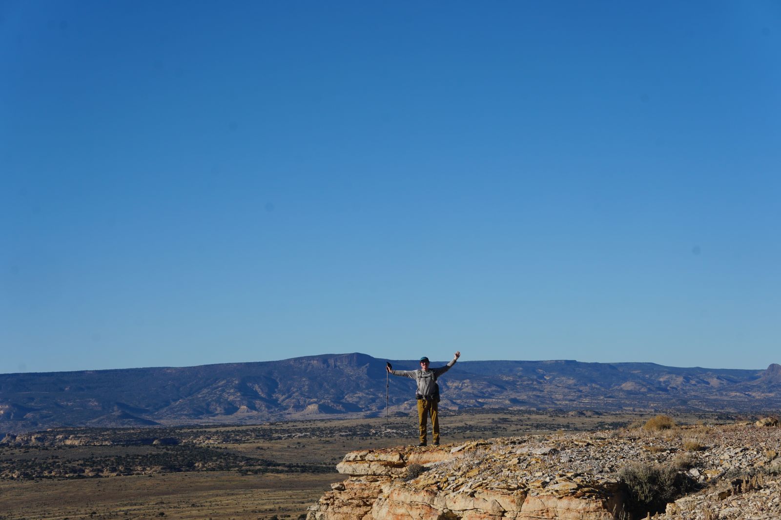
It’s pretty flat in New Mexico
Ratatouille navigating a dangerous pass in the San Juans
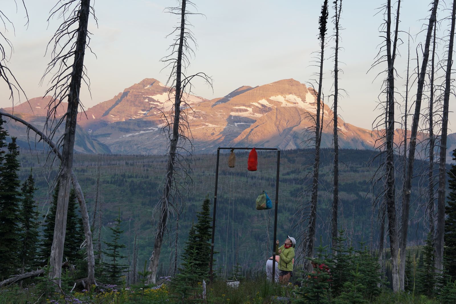
Bear hang in Glacier National Park (elsewhere, you’ll have to find a branch)
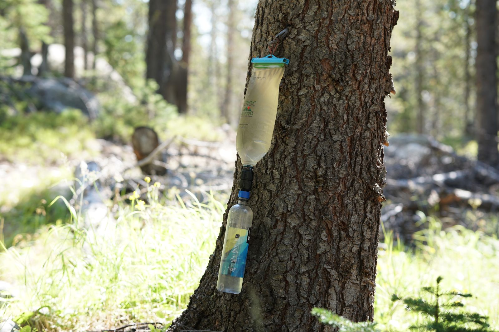
Filter all of your water. Boil it too if it looks bad. Most people hiking the CDT use a Sawyer Squeeze or similar micro-filtration device. Do not get a smaller version (mini or micro) to save on weight; these suck in comparison to the original. We primarily used a gravity system using the Sawyer, the blue screw-on connector, and our Smart water bottles. Hike smarter, not harder.
We started our CDT thru-hike the very next day after arriving in the US. Yes, we were a little concerned about making it through Colorado in time, but starting with jetlag is rough, and it diminished our experience through one of the most beautiful places along the trail - Glacier National Park.
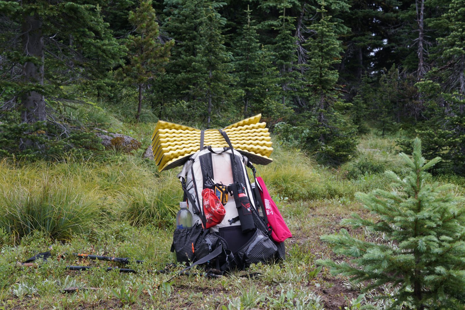
Gossamer Gear Mariposa 60L and Hyperlite Unbound 55L
I’ve used my Gossamer Gear a bunch for different thru-hikes, rock climbing trips, and more. It’s been through a lot - it’s full of sewn-up holes and patches. I’m surprised it lasted the whole trip with little additional wear and tear. However, I do think my partner’s Hyperlite is a more appropriate pack for a trip like this - it’s more durable, waterproof (I had to use a heavy packliner), and a bit lighter as well. If you can afford that and you don’t mind a frameless pack, something like the Hyperlite is the way to go.
Hyperlite Unbound 55L in the wild
Big Agnes Copper Spur HV UL3 Bikepacking Tent
This tent just plain rocks. Unlike other long thru-hikes I’ve done, the CDT requires you to tent basically every night. You are going to be spending a LOT of time in your tent. That’s why I opted for my most spacious and convenient tent. We had so much room in this bad boy (2 people in a 3-person tent), so much pocket space to hang things (including a phone for a makeshift suspended television), and it’s honestly not that heavy, especially split amongst two people.
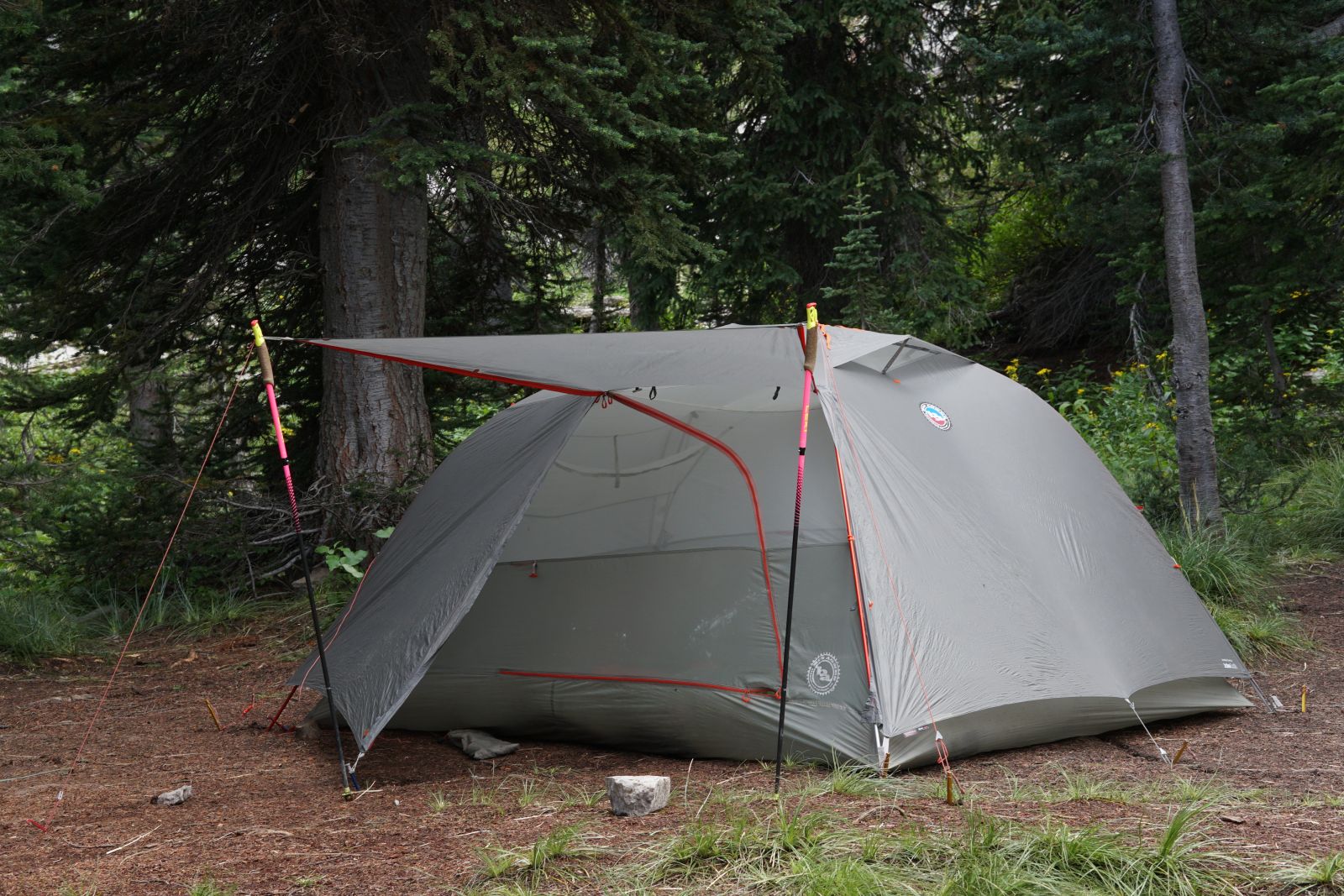
I was surprised to see a bunch of other CDT hikers with the same tent in various sizes. But the Short Stix on the bikepacking version is actually perfect for side pocket storage, and you don’t need to worry about the inevitable breaking of trekking poles along the way.
Having used it on many previous trips (including a cycle from Brisbane to Darwin), this tent has already been through the wringer. Fortunately, Big Agnes makes their tents in Steamboat Springs, which is a town you stop in along the CDT. They helped us repair a few minor problems along the way (new grommets) and straight-up replaced our tent when we returned post-trip with no longer functioning internal zips from so much wear. I can’t recommend Big Agnes tents enough. And visiting their store in Steamboat Springs showed me that they’re also leading the way in modern pack design (although I don’t think they’ve reached Australia yet, but I will buy one as soon as they do).
Enlightened Equipment Revelation Apex -6°C Synthetic Quilt
This bag is not warm enough to be appropriate for the CDT. The advertised rating felt more like an upper or extreme limit, and I spent a few nights cold in this bag before getting my original winter bag. It would be the perfect companion for the Appalachian Trail or our own thru-hikes in Australia.
Sea to Summit Spark -9°C Down Sleeping Bag
I swapped to an older model of this bag that has also seen some days. But after a replacement zip and a tumble dry with some tennis balls, my bag came back to life and kept me more than warm. These bags are incredibly light for how warm they are and can squish super small. A must-have for any long hike where it can get a weebit cold. I paired this with my Sea to Summit Reactor Extreme sleeping bag liner for extra warmth and to keep my bag alive as long as possible.
Sea to Summit Ether Light XR Sleeping Mat
This mat has been a game-changer for me. Though heavier than previous mats I’ve used, the comfort provided by the 10cm stack height more than makes up for this. No holes, even when travelling through the cactus-filled desert.
Sea to Summit Aeros Ultralight Pillow
I take this 70g pillow on all of my longer adventures.
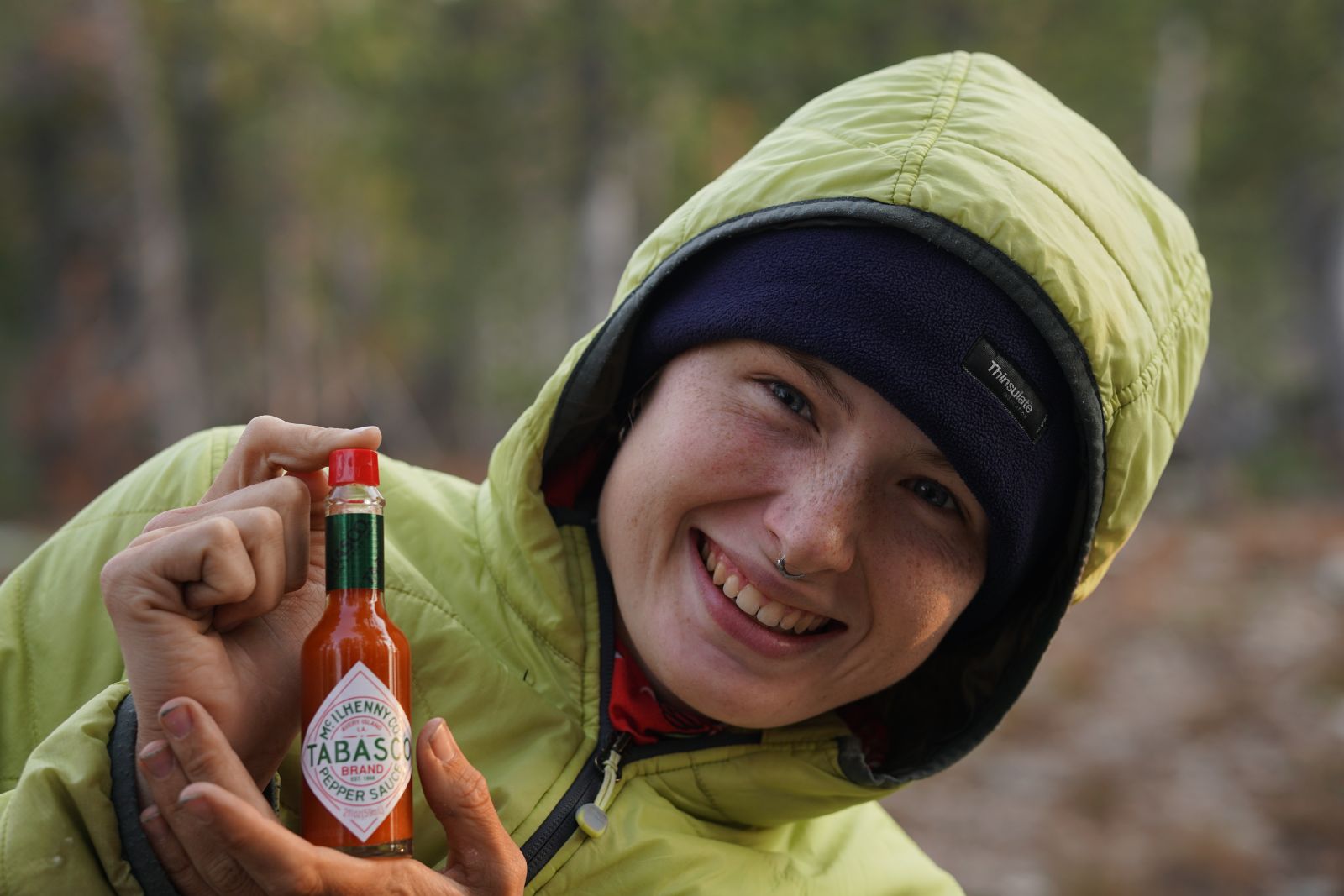
For dinner, I mainly ate Idahoan instant mashed potatoes. These are readily available throughout the US (including gas stations), provide plenty of calories, have multiple flavour offerings, rehydrate instantly, taste great, and pairs well with Tabasco. I have a strong aversion to oats after previous thru-hikes, so breakfast was predominantly just snack bars.
Lunch was commonly bagels or tortillas with an available spread (I wish the US had Vegemite).
Patagonia Capilene Cool Dail Mens Hoody
We both wore this shirt every day for the entire trip. It is perfect for sun protection during the long, summer days. We used the hoods a lot, pairing them with our Sunday Afternoon caps. These shirts are high-quality, super comfy, and incredibly durable.
Just some super comfy and lightweight shorts. I wore these shorts for approximately a third of the trip, before it got too cold to be walking around with my legs exposed. I swapped to a long pant, which I picked up in a small town along the way.
Exofficio Underwear x 2
These are the best and most durable undies I’ve ever worn, and I can’t recommend them enough for long hikes. You can buy them online in Australia, but I would recommend getting them in the US for a lot cheaper and a much broader selection. Alternatively, Wild Earth stocks Icebreaker merino underwear which also works great and is really comfy.
Injinji Midweight Toe Socks
I believe injinji toe socks, specifically the midweight variety, are the best socks for long-distance hiking. Minimising blisters is important for the start of your trip before your feet become callouses, and the thicker fabric is essential to increase lifespan and reduce friction on the base of your foot.
Patagonia Nano Puff Jacket
Just a great, lightweight jacket. It was stored for a lot of the first half of the trip (only put on at night), and worn on my body for most of the rest. Pair these with the Nano Puff mittens, and you’ll be toasty in no time (these are hard to find in Australia, but are an excellent, all-round, lightweight mitten).
So nano puffed
I would almost forget I was carrying this guy until it started to rain. It takes up next to no space, is super light, and does a fantastic job in serious rain and snow.
Melanzana Micro Grid Hoodie V2
This is the best and most stylish warm layer that I own. These are sewn in Leadville, Colorado, which the CDT passes through. Usually, there is a 6-month waitlist to be able to grab one of these fleeces/ However, they waive this waitlist for CDT hikers, allowing you to grab a much-needed additional layer for the freezing Southern Colorado. Alternatively, Wild Earth stocks The North Face Glacier ¼-zip. This is a classic lightweight and warm fleece that’s made of 100% recycled fabric.
Decent base layers are pretty essential for the CDT
Wombat in the San Juan Mountains of Southern Colorado
Trail Running Shoes: Altra Lone Peak 9+
These are a perfect shoe for thru-hiking. However, due to the weight of a hiking backpack and the swelling of my feet, these quickly became too small for my feet and I needed to replace them before they had reached the end of their lifespan.
Altra Mont Blanc
I grabbed these at a great discount at a store along the CDT. I was surprised how both light and comfortable these were. The elimination of any heel padding turned out to be a good idea, as I would have worn through all of the padding if it were there. These lasted over 1000 miles of use, I would definitely buy these shoes again, even when not on sale.
The Torin’s are maybe my favourite Altra shoe. Though designed specifically for road running, I use them for everything. They are likely the most durable Altra shoe I’ve used and were perfect for the last 700+ miles through the New Mexico high desert.
Kahtoola Microspikes
Essential for living on the more wind-blown mountains and passes. People get rescued off these mountains in the best of weather, let alone in the snow/ice. You can grab these as you get closer to Colorado if you don’t want to lug them along for 1500 miles.
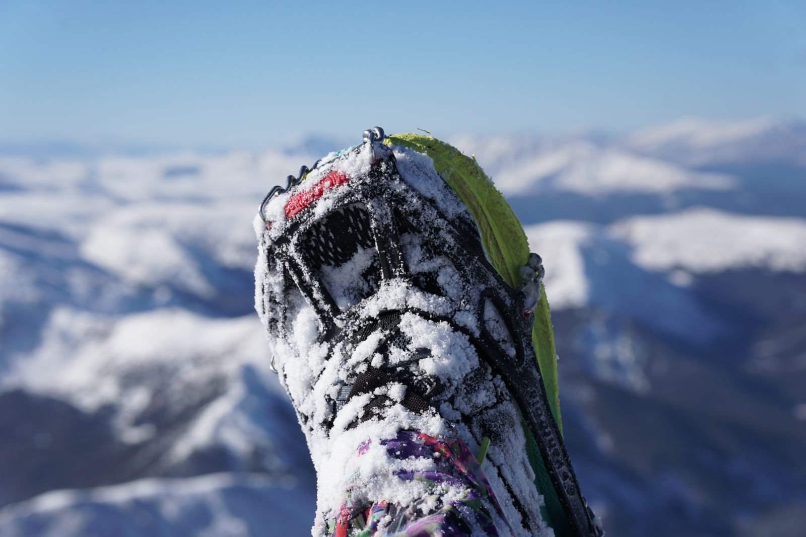
Spikes attached to my Torin 8’s coming in clutch for a serious ascent
Leki Ultratrail FX One Trail Running Poles
I used these poles on a handful of trail races over the last few years, and during my fastpacking trip on the Bibbulman Track. They are great poles, incredibly light and strong power generation when paired with the gloves. These poles lasted about 800 miles along the CDT before they had issues (one broke internally at the cord, and the other snapped when I took a big fall on some rocks). I enjoyed using them while they lasted. My partner's non-carbon Leki poles survived the entire journey unscathed!
Power Bank + US Wall Plug (adaptor)
We collectively used a single 10,000mAh power bank that I got with Flybuys points years ago. This was enough for us both to use our phones regularly on Power Saving and Aeroplane mode, including watching some downloaded television at night. Our headlamps and camera were just charged each time we got to town using a light wall plug (3-6 days in the woods). Wild Earth stock the Dark Energy Poseidon Pro Waterproof Lithium Ion Power Banks which is also 10,000 mAh and weight only 271 grams.
Black Diamond Cosmo 350 Rechargeable Headlamp
Any rechargeable headlamp over 300 Lumens should suffice. I personally really like the red light to minimise disturbing other people at night.
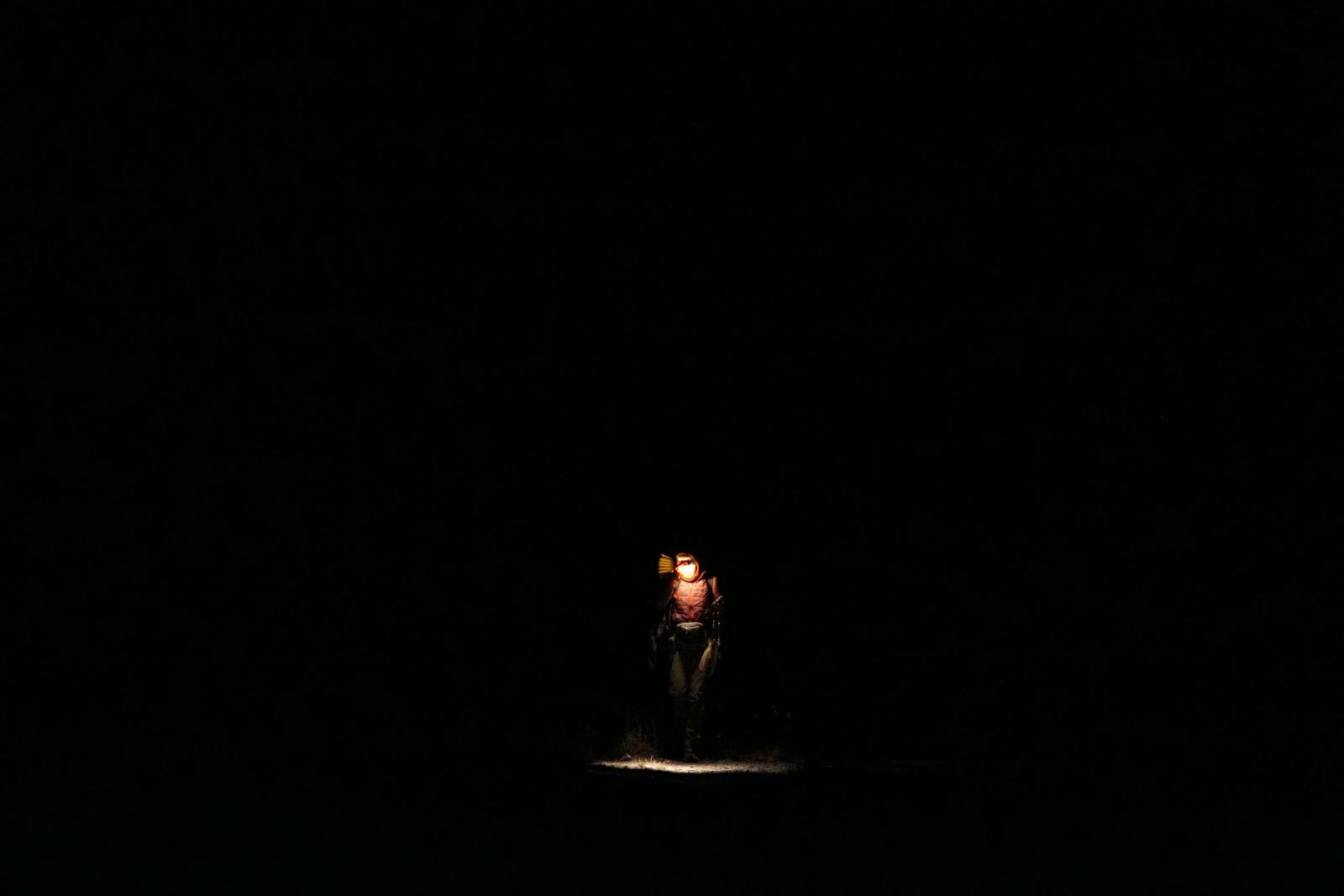
Hiking in the dark is a valuable tool for avoiding consistent afternoon weather patterns
Ocean Signal RescueMe PLB1
This is a great, lightweight PLB that can last 7 years on a single battery. Unlike the Garmin InReach, there is no subscription required. However, there is no satellite messaging or any other feature other than emergency signalling.
Victorinox Classic Pocket Knife
This is a fun companion for any trip. Cut cheese (we even cut up a rockmelon with this), file your nails, open annoying packets.
Not sure what gear you need for your adventure? Chat with our friendly team of Outdoor Gear Specialists in-store or online today, and don’t forget to share your adventures with us on Instagram by tagging @wildearthaustralia in your next post.
Q: What is the Continental Divide Trail (CDT) and why is it considered so hard?
A: The CDT is a long-distance hiking route that follows the Rocky Mountains from the Canadian border to the Mexican border. It is considered one of the toughest thru-hikes because conditions can swing wildly by region and season, with snow, lightning, heat, long water carries, remote logistics, and frequent route alternates (often due to wildfires).
Q: How long does it take to thru-hike the CDT southbound?
A: Most southbound (SOBO) hikers take about 120 to 150 days, including rest days in towns. Your pace will probably change by state. Wyoming can allow big-mile days, but Colorado often slows you down thanks to altitude, steep terrain, and rough weather.
Q: How many kilometres is the CDT really?
A: The official CDT distance is often quoted around 4,878 km, but real-world mileage varies. Depending on wildfires, alternates, and your own route choices, many hikers end up closer to 4,506 to 4,989 km.
Q: When is the best time to start a southbound CDT thru-hike?
A: A common sweet spot is early to mid-June for SOBO. This timing is often late enough to reduce snow trouble in the north, while still giving you a decent chance of getting through Colorado before deep cold and heavy snow hit in autumn. Start later and you might get fewer bugs and nicer days up north, but you also increase your odds of getting properly snowed on in Colorado.
Q: What permits do you need for a CDT southbound start in Glacier National Park?
A: If you start in, or pass through, Glacier National Park, you will need backcountry permits for camping. These can be competitive. Many hikers aim to secure permits in person with some flexibility, using walk-in availability set aside for CDT hikers.
Q: What is the best navigation app for the CDT?
A: Most CDT thru-hikers use FarOut for navigation and logistics. It is popular because it combines GPS navigation with current, crowd-sourced trail notes. This helps a lot with water reliability, hazards, closures, and alternates. Budget roughly about $80 AUD based on your notes.
Q: How do you plan water on the CDT, especially in Wyoming and New Mexico?
A: Water can go from easy and abundant to long carries and questionable sources, sometimes within the same week. In exposed areas like the Wyoming Basin, you may face very long water carries with few natural sources, and you might rely on cattle ponds or wells. A smart approach is to:
Q: Do you really need bear spray on the CDT?
A: In grizzly country, especially Northern Montana, bear safety is serious. Carry bear spray where you can access it quickly and practise using it so you are not fumbling when it matters. Food storage matters too. Use a bear hang method where appropriate, or store food in an odour-proof bear canister system, depending on the area and rules.
Q: What is the biggest weather danger on the CDT?
A: Lightning is a major threat in the Rockies. Storms can build fast, and you do not want to be above treeline when it kicks off. A good habit is to plan passes and ridgelines early, then drop lower when storms are forecast. Simple, but it saves lives.
Q: What gear mistakes do first-time CDT thru-hikers make?
A: A few common ones:
Q: What sleeping bag temperature rating do you need for the CDT?
A: In the heights of Colorado and in the exposed deserts of New Mexico, temperatures can plummet well below freezing. I recommend a bag that has at least a Womens Comfort Rating of -9°C/15°F, and warmer if you sleep cold (assuming you have a good liner and several warm clothing layers). Don't skimp out on a quality sleeping bag, as you'll end up having to buy a new one just to survive. We met people who had to end their CDT journey short as they weren't prepared for these temps.
Q: Is the CDT safe for non-US hikers and what is the hardest part of logistics?
A: It can be done, but logistics can be a grind. Airports, shuttles to trailheads and termini, permits, remote resupplies, wildfire reroutes, and expensive rides in and out of places like the southern terminus area. The key is padding time and money for the unglamorous parts, like transport, alternates, and town logistics.


The Bibbulmun Track is Australia's longest marked walking track, spanning 1,000 kilometres from Kalamunda in the Perth Hills to Albany along WA’s southern coastline.

Over the past eight years, I’ve been lucky to race through some of Australia’s most stunning and remote landscapes. My constant companion on this thrilling journey? The Sea to Summit Solution Gear Quest PFD—quite literally, a lifesaver.

The 96km Kokoda Challenge on the Gold Coast is one of Australia’s most iconic and physically demanding endurance events, designed to test the limits of participants both mentally and physically.

The best year ever doesn’t just happen; plan ahead with intention to make space for your adventures.


Using Afterpay you can pay for your order over 8 weeks. There's no interest or added fees* and nothing to pay today. Payment will be automatically taken from your debit or credit card in four equal payments each fortnight over 8 weeks, and you will receive your order immediately.
You simply need:
To use this service simply:
Approved AfterPay buyers will require the funds for the first payment to be available on their card at time of checkout, however the first payment won't be deducted for 14 days. First time AfterPay buyers will need to make the first instalment payment at the time of their purchase.
If you wish to return your goods you can choose to receive an exchange, or the Afterpay payment plan can be cancelled before the first payment at no charge. *If you fail to have sufficient funds available for AfterPay to automatically deduct payment on due instalment dates you will be charged a late fee of $10, and if the instalment payment remains overdue, an additional $7 will be charged one week later.
With AfterPay, there's no waiting and we'll ship out your order immediately as normal.
When you want to go now, sometimes it's handy to pay later. That's why, we offer interest free payment plans from two of Australia's favourite Buy now, Pay later services.